

Noteworthy Hike in TAG: Prentice Cooper State Forest
- Jan 31, 2017
- 6 min read

Noteworthy Hike in TAG
Activities: Hiking, Camping, Rock Climbing, Bicycling, Photography, Nature Appreciation
Rating: Easy to Difficult
Prentice Cooper State Forest is located in southeastern Tennessee, in Marion County. The forest is over 24,000 acres, is approximately 10 miles west of Chattanooga and is situated on the scenic Tennessee River Gorge. The Prentice Cooper property was acquired by simple purchases between 1938 - 1944 and the site was proclaimed a State Forest in 1945. Sixty-nine percent of the forest is in multiple-use regulated forests and the remainder is in conservation areas. Approximately 6,939 acres are designated as unregulated scenic zones that protect this view shed and other scenic areas of the forest. Hicks Gap Natural Area (350 acres) also occurs in the forest and was developed to protect the federally endangered Large-flowered Skullcap. The forest also includes several in-holdings owned by Tennessee Wildlife Resources Agency and 3 cemeteries. Management activities of the forest focus primarily on sustainable timber management, forest management demonstration and wildlife habitat improvement while maintaining recreational opportunities for the public. There are 35 miles of hiking trails, including the south end of the Cumberland Trail State Park. There also are two designated camping areas. The Tennessee Department of Agriculture, Forestry Division has provided labor and portions of the forest for various types of research in collaboration with the University of Tennessee. Hunting has been a traditional use of the forest, while other recreational activities include OHV use in designated areas, rock climbing, hiking, Mountain biking, horseback riding, bird watching, and camping.
Cumberland Trail – The Cumberland Trail was established by an act of the Tennessee General Assembly in 1971. It is a state scenic trail and a component of the Tennessee Outdoor Recreation Area System. When complete, the Cumberland Trail will traverse the state by going from Prentice Cooper State Forest to Cumberland Gap National Historical Park near Middlesboro, KY. The southern end is the first section of the trail to be developed. It begins at a parking area at Prentice Cooper State Forest, and makes its way to the Grand Canyon of Tennessee. The trail follows the magnificent river gorge for several miles, passing through ancient Indian rock houses and topping spectacular rock bluffs. The trail then turns north up the Suck Creek Gorge. It descends to cross both North and South Suck Creeks, and then ascends again to continue its course to an outstanding vista at Edward’s Point. From here, the trail follows and eventually crosses Middle Creek on its way to another access and parking area at Signal Point Park in Signal Mountain. Eventually the main trail route will turn north up North Suck Creek. Total length of the trail one way is 13.7 miles.
Mullins Cove Loop Trail - Coming in at just around 10 miles, Mullen's Cove Loop is an incredibly diverse trail. A significant length of this trail hangs airily along the edge of a 1,000 feet of vertical drop down to the Tennessee River. Many spots along the trail offer peaks into the depth of the river gorge which has carved its way through 26 miles of the Cumberland Plateau. The most spectacular view into the gorge comes just before the trail turns westward into the Mullen’s Creek drainage at Snooper’s Rock. The trail is generally gradual in its relief but not without a few steep switchbacks to sizzle your calves and quads. Creeks gurgle and bubble along before plunging steeply over the breach into the rocks below on their way to the Tennessee River. Lichen and moss encrusted outcrops of rock emerge from the soil creating a stunning collage of texture and color that changes as the canopy morphs with the seasonal shifts. The mesophytic forest of the Cumberland Plateau is home to a great diversity of trees. Some of the more dominant tree species include: American Beech, Yellow poplar, Hickory, Eastern Hemlock, Loblolly Pine, and many varieties of Oak.
Pot Point Loop – This 11.9 mile loop offers grand views of the Tennessee River Gorge and takes you over a large natural bridge. There is a view of Raccoon Mountain across the river gorge and Ransom Hollow overlook is one of the best views in the region. Along the trail camping is available at McNabb Gulf campsite and Hemlock Branch campsite.
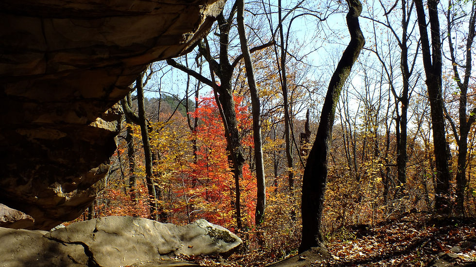
Indian Rock House & Snoopers Rock – If you are interested in taking a shorter hike, you can do a 6 mile round trip hike from Indian Rock House to Snoopers Rock and back. Park at the parking area for Indian Rock and follow the trail to the overlook at Snoopers Rock. You can also opt to drive further down Game Reserve Road and park and hike the short 0.3 mile hike down to the overlook and back. From Snoopers Rock to the Natural Bridge is 2.8 miles each way.
Directions from Jasper, TN: Take TN 28 N for approx 9-1/2 miles. Make a right onto TN 283. Follow 283 for about 8-1/2 miles and look for the signs pointing right onto Carson Road. Follow signs from here into the State Forest.
Directions from Chattanooga, TN: Take Hwy 27 to the Signal Mountain Exit. Turn right onto Signal Mountain Road then left onto Hwy 27 (Suck Creek Rd). Continue on Hwy 27 for approx 8 miles into Marion County. Look for signs pointing you to turn left onto Choctaw. Follow around to the left and take a left onto Game Reserve Road following it into the State Forest.
The Tennessee Wall – The Tennessee Wall is located on River Canyon Road (aka Mullen’s Cove Road). The trail head and the majority of the crag lie within Prentice Cooper State Forest and WMA, with a significant portion of the crag crossing over onto the Tennessee River Gorge Trust. This gem was largely developed by legendary climber Rob Robinson. The cliff, with a gold mine of classic cracks and mind blowing roofs, is one of the best crags in the south, and North American in general. The mission of the Tennessee River Gorge Trust is conservation and preservation and it is private land. Though their relationship with climbers is a positive one and permission to climb there has not been granted nor is a closure being enforced. Please be ultra responsible and have a low impact on the area. When visiting the wall do not park on the road as this blocks local traffic.
The Prentice Cooper Climbing Management Guidelines specifically state that a permit is required to install bolts and other fixed anchors in Prentice Cooper. Any unauthorized bolting is considered vandalism and jeopardizes the good relationship that climbers have developed with the Forestry Division. Camping is available near the parking lot for the wall but it is limited and is not an officially recognized campsite by the Forest. Camping on the north side of the road is prohibited. Please not climbing is NOT allowed at Indian Rock House, Snoopers Rock or the Bluff view at the end of Tower Road.
Seasonal Closures: If you are visiting during hunting season, please make sure to check the Prentice Cooper web site for scheduled hunts before your visit. Also some areas are closed from late April through early July to encourage turkey nesting. Turkeys do not like to be disturbed during the nesting period; therefore some areas are closed to motorized vehicles during this time. Areas closed include: Tower Drive south of Pot Point Road, Elder Point, Long Point and Inman Point. During the winter months the side roads are closed during periods of wet weather. Winter months bring a lot of rain and snow along with freezing and thawing. These conditions make the dirt roads soft and muddy and susceptible to damage, rutting, and erosion problems.
http://www.tn.gov/agriculture/forestry/stateforest07.shtml
Prentice Cooper State Forest Trail Mileage
Cumberland Trail
Parking area to Poplar Springs Campsite 3.3 mi.
Poplar Springs Campsite to Hwy 27 2.3 mi.
Hwy 27 to North Suck Creek 1.4 mi.
North Suck Creek to Edwards Point 2.7 mi.
Edwards Point to Signal Point 2.7 mi.
Total 13.7 mi.
Mullens Creek Loop Trail
Parking area to Indian Rock House 0.7 mi.
Indian Rock House to Snoopers Rock 2.7 mi.
Snoopers Rock to Hemlock Branch Campsite 1.1 mi.
Hemlock Branch to Mullen’s Cove overlook 0.3 mi.
Mullen’s Cove Overlook to Haley Road 2.2 mi.
Haley Road to Parking area 3.2 mi.
Total 10.2 mi.
Pot Point Loop Trail
Snoopers Rock to Natural Bridge 2.8 mi.
Natural Bridge to Pot Point Road 2.1 mi.
Pot Point Rd To Raccoon Mtn Overlook 1.5 mi.
Raccoon Mtn. Overlook to McNabb Gulf Camp 1.8 mi.
McNabb Gulf Camp to Tower Drive 0.7 mi.
Tower Dr. to Ransom Hollow Overlook 0.8 mi.
Ransom Hollow to Trail Jctn at Hemlock Branch 1.3 mi.
Trail Junction to Tower Drive 0.6 mi.
Tower Drive to Snoopers Rock 0.3 mi.
Total 11.9 mi.

Comments